Newsletter Subscribe
Enter your email address below and subscribe to our newsletter
Tornado Threat Increases Tonight as Arthur Moves Inland
As Tropical Storm Arthur pushes inland tonight, weather experts are warning that Southeast Louisiana could see the development of quick spin-up tornadoes within the storm’s outer rain bands.
Unlike the large tornadoes often seen across the Plains states, tropical tornadoes tend to form rapidly with little warning. These tornadoes are usually smaller and shorter-lived, but they can still cause significant damage to homes, businesses, trees, and power lines.
The greatest concern is that these tornadoes often develop inside heavy rain bands, making them nearly impossible to see until they are very close. Many occur at night when residents are sleeping, reducing the amount of time people have to react.
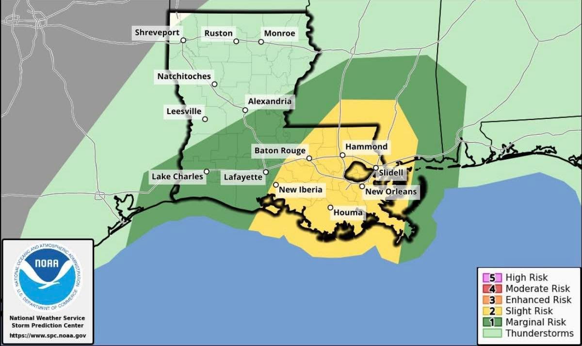
Forecasters say the risk will increase as bands of heavy rain rotate inland overnight. Areas from the Louisiana coast through the Northshore, including St. Tammany Parish, could see conditions favorable for isolated tornado development.
While most tropical spin-up tornadoes are weaker than traditional tornadoes, they can still be dangerous and should be taken seriously. Residents are encouraged to have multiple ways to receive weather warnings overnight, including weather radios, smartphone alerts, and local weather apps.
The tornado threat is expected to continue as Arthur moves across the region, bringing heavy rain, gusty winds, flash flooding, and the potential for isolated tornadoes through the overnight hours.