
Get Slidell & St. Tammany News
Enter your email below to get local news in your inbox.

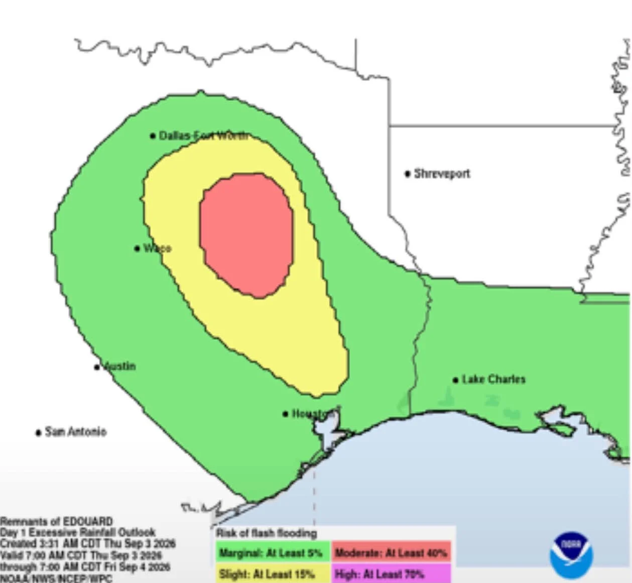
Edouard has weakened from a tropical storm to a tropical depression, but the danger is far from over for the Gulf Coast. Heavy rain and flash flooding continue across southwest Louisiana and eastern Texas as the system slowly moves inland.
The storm came ashore Tuesday afternoon near Johnson Bayou, Louisiana, close to the Texas state line, with sustained winds near 60 mph. It was the third named storm to make landfall along the Gulf Coast this year, following Arthur in June and Bertha, which struck twice in July, once east of New Orleans and again near the Texas Louisiana border.
Along the Louisiana coast, Holly Beach in Cameron Parish saw rough surf and choppy Gulf waters as the storm pushed ashore. Wind gusts reached as high as 90 mph in Port Arthur, Texas, with gusts over 70 mph reported closer to the Louisiana line in Nederland and Beaumont.
The storm knocked out power to nearly 82,000 customers Tuesday night. As of Wednesday, about 71,000 customers were still in the dark.
Rainfall has been extreme in some areas. Parts of eastern Texas have already seen more than 20 inches of rain, with forecasters warning up to 6 more inches could fall Thursday. The National Weather Service says a major flash flood risk will continue through Friday morning, and isolated major river flooding is possible over the next several days as rivers rise from the runoff.
Forecasters say no other tropical development is expected in the Gulf over the next week, giving the region a brief break once Edouard finally clears out.






How is this affecting you and your neighborhood? Join the conversation below.
Free. Straight to your inbox. Cancel anytime.



Join the conversation — create a free TRH News account to comment.